
The floor plan of a public library
The diagram below shows the floor plan of a public library 20 years ago and how it looks now.
The diagram below shows the floor plan of a public library 20 years ago and how it looks now.

The maps below show an industrial area in the town of Norbiton, and planned future development of the site.
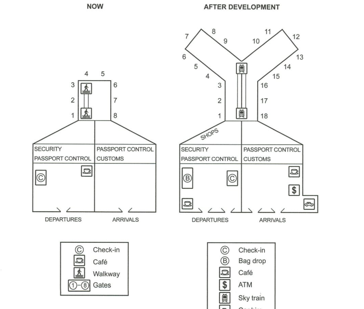
The plans below show the site of an airport now and how it will look after redevelopment next year.
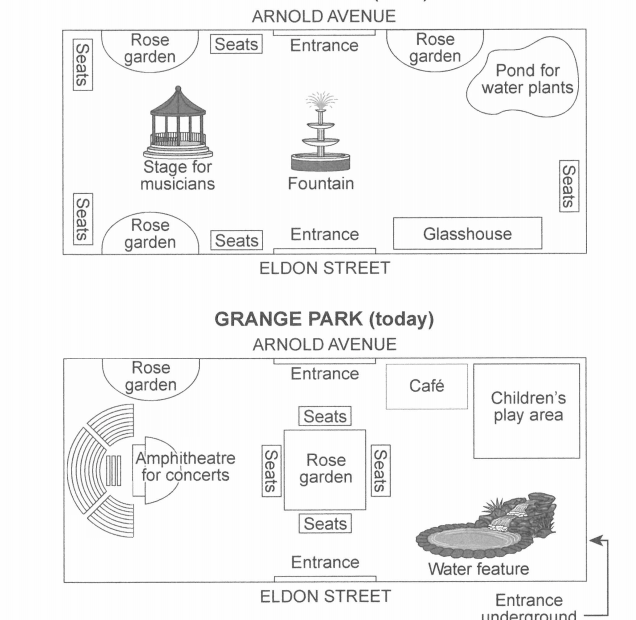
The plans below show a public park when it first opened in 1920 and the same park today.

The plans below show the layout of a university’s sports centre now, and how it will look after redevelopment.
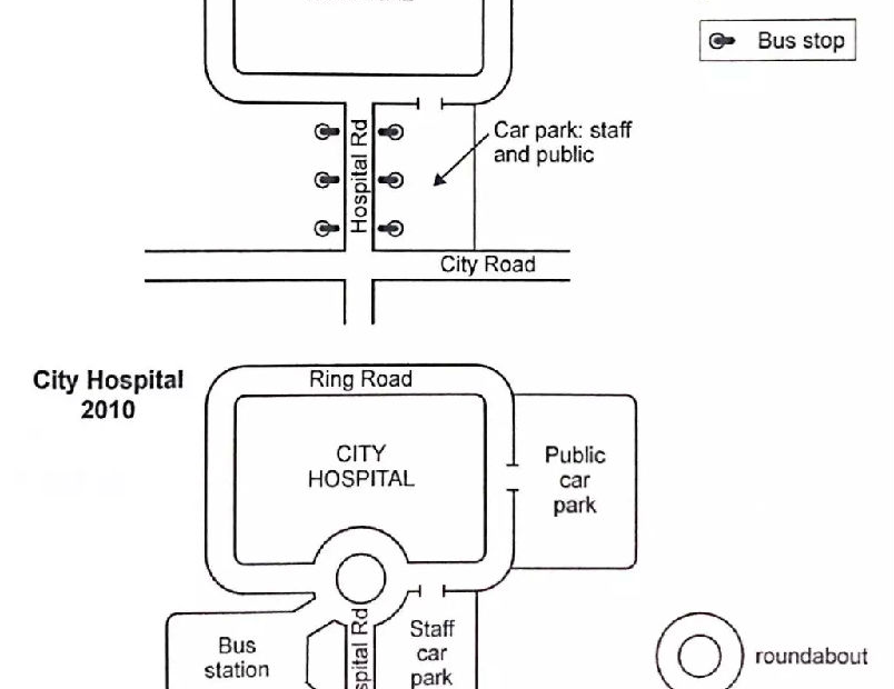
The two maps below show road access to a city hospital in 2007 and in 2010.

The maps below show the centre of a small town called /slip as it is now, and plans for its development.
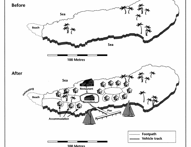
The two maps below show an island, before and after the construction of some tourist facilities.

The map below is of the town of Garlsdon. A new supermarket (S) is planned for the town. The map shows two possible sites for the supermarket.
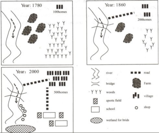
The diagram below shows the development of the village of Kelsby between 1780 and 2000.